Preface: This was a very special trip that took immense planning and acts of God to come together. Not only did we have to reservations many months ahead of time, but finding accommodations that accept dogs because they had to come with us due to lack of boarding in Dawson City. We fretted at one point previously in our trip because our reservation for Inuvik was canceled unexpectedly, but luckily we were able to find an opening elsewhere. Also, we had to trust that the 2 ferries that were on the Dempster Hwy would be open and running. That required the act of God to break and clear the ice on the Peel and Mackenzie Rivers and have the appropriate level of water for the ferry crews to work on and manage the ferry landings on their respective rivers. It was getting close to a week before we were scheduled to embark on this journey and we got news that the ice was just breaking on the rivers, which was later than their usual ice break thanks to a late spring. Then we started to get good news and Mackenzie River ferry was open on June 6 and remained open. So now we just hoped and prayed the Peel River ferry would open, and we got news that it opened on June 8, two days before we were scheduled to leave! Then, it closed and opened a couple of times before June 10 due to high water levels because of recent rains. All we could do it hope it would be open when we came across it's path...
June 10-13: We had packed as much as we could think to bring, including some easy on the go meals that would only require a heat source. We loaded the truck the night before so we could get an early-ish start. We only took our kayaks with us with the plan to kayak in the Arctic Ocean. Not only touching the Arctic Ocean, but kayaking! Sean and I had been told by a Visitors Center that the Arctic would still be iced in, so our chance may be low to kayak, but we were still determined even if we had to push our kayaks across the ice, lol.
We were expecting to get extremely dirty on the Dempster Hwy, so I got a "before" picture of the truck.
Everyone packed in!
Dempster Hwy turnoff.
Very beginning of the Dempster Hwy.
Starts off with a wooden one lane bridge.
The Arctic Ocean 880km (546.8 miles). The Dempster Hwy was completed and opened in 2017, so this journey was not possible by vehicle the last time we were here in 2013.
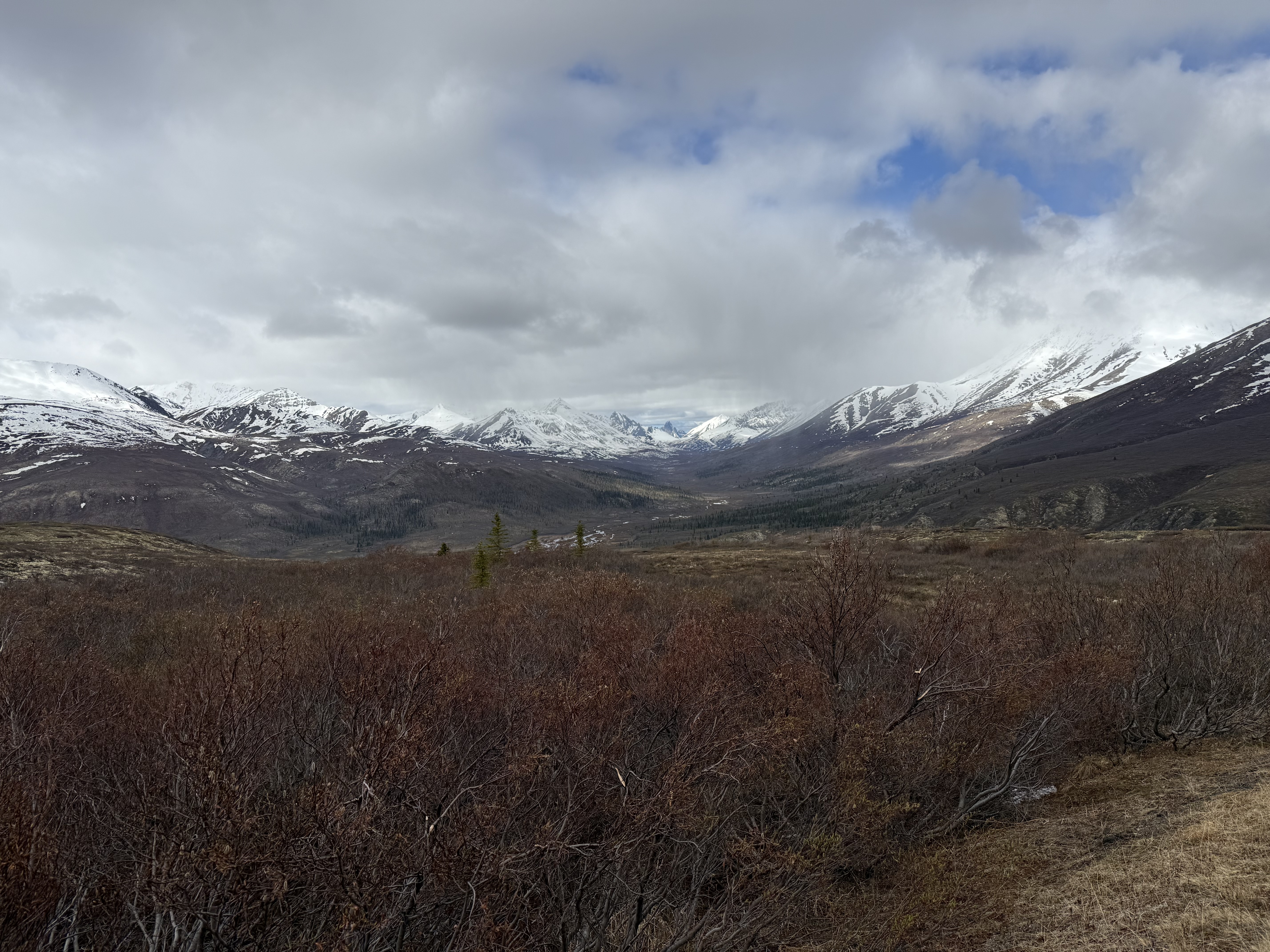
Beautiful views of the mountain ranges in Tombstone Territorial Park in Yukon Territory.
We briefly stopped at the Tombstone Interpretive Centre.
It was a very neat experience to feel a bear's fur. Much thicker than one would think.
Tombstone Mountain Range.
We stopped at Goldensides Trail for a hike for a stunning view.
It was very cold, but after hiking a bit we both stripped down to our sweaters.
After 1.2km the trail was closed due to snow.
Although, we weren't able to complete the full hike there was still a beautiful view.
We got back on the road and soon it started to rain making the dirt road a bit nasty.
Still lots of ice in the river the road paralleled.
There were occasional muddy areas that were still passible.
This was one of the many interesting rigs that we saw on the Dempster Hwy.
Finally we made it to our stopping point for the night, Eagle Plains Hotel.
After checking in, we were starving! The only place to eat was at the Hotel Restaurant.
Sean noticed that his watch only showed "----" for the sunrise and sunset for our location. Very close to the Arctic Circle.
After what seemed like forever, actually only 20 minutes, we got our food! Chow time!
Our friend here was politely asking for us to drop some food for him, lol. Of course, the puppy-dog eyes got to us and he got a couple of fries. He knew who the suckers were in the room.
Drawn map of the Dempster Hwy up to Inuvik, NWT.
After dinner, we took the pups for a much needed walk to stretch our legs. Most of the walk was on the Dempster Hwy.
The only fuel available for the first half of the Dempster Hwy by the Hotel. It was not cheap.
The hotel room was very clean and as nice as you could expect for the middle of nowhere. It was quite warm in our room due to facing the sun (which didn't set) and no AC installed for the hotel.
The next morning, we admired the beautiful sheen of dirt layered on mud layered on dirt that the truck had on it. We quickly loaded up and headed out without refueling due to the price.
There is an airplane runway on the Hwy.
Shortly, we were at the Arctic Circle! This makes twice that Sean and I have crossed the Arctic Circle. From this point on, we did not experience the sun setting at all for the 3 days we were visiting.
Getting closer!
Very steep part of the road with some muddy areas in the shade.
Sean needed to stretch his legs and stopped near a patch of snow. The pups happily joined him for a bit of exercise in the snow!
Surprised at how much snow there is still.
Northwest Territories border! Home of the polar bear license plate.
The terrain is getting a bit flatter.
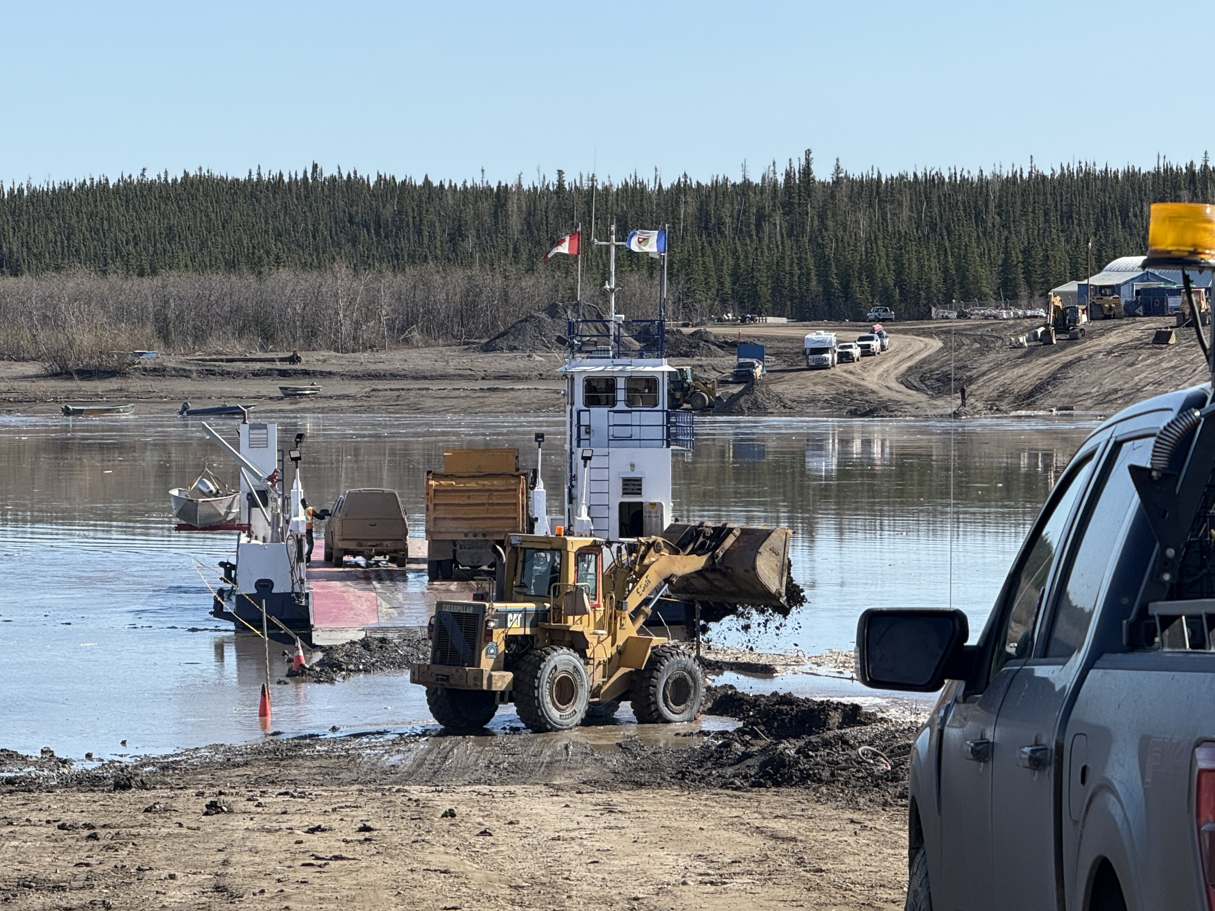
Peel River ferry crossing.
As you can see in the center of the photo, we are driving into the river to get on the ferry...
Peel River ferry video.
Once we were on the other side of the river, we stopped into Fort McPherson for fuel... it was still expensive, but nothing like at Eagle Plains.
I still have no idea how to pronounce the name of the this village, but this is a village that is only accessible by ferry or boat.
You can see the village on the right of the photo. The Mackenzie River on the left and a tributary of some sort extending from the Mackenzie River to the right center of the photo, thus isolating the village from main roads.
Mackenzie River ferry.
Video of crossing.
The Dempster was pretty rutted in areas and narrow, but again still passible.
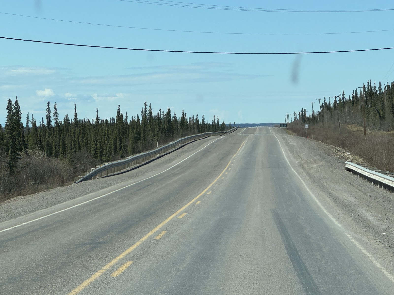
We hit pavement! This means we are close to Inuvik.
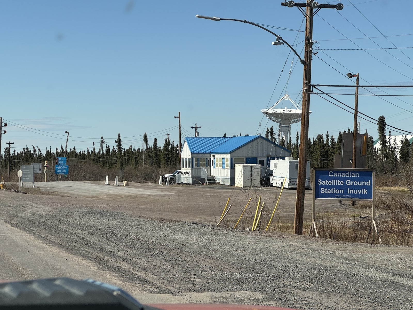
Interesting sight to see a satellite station here.
Yay!
We finally arrived at our accommodations for the next 2 nights. Arctic Chalet.
This was our cabin.
We all very much approved the accommodations, which included a small kitchen.
More layers added on, lol.
After we had checked in and unloaded the truck, we went into Inuvik to firstly find somewhere to eat and then explore.
Sean found us a local restaurant called "The Roost" which turned out pretty tasty and the cook was pretty entertaining while he was singing along to his very loud Spotify list.
One of the two markets in Inuvik. This one was also a department store, sold snowmobiles, and has the only fast food restaurant in town.
Grocery store KFC!
We found it interesting to look at the difference in prices for basic items. Click on the photo and zoom in on the price for sugar. This is a Canadian store, so there is a markup in price due to the current exchange rate.
Sean had been looking for this snack to try. Turns out, it's pretty tasty!
Here is peanut butter pricing.
We were a little confused by this Canadian Naval ship on a channel of the Mackenzie River... not sure exactly what the necessity is for it.
An Inuit stone landmark that we called "stone man". You can see the Igloo Church in the background.
Igloo Church, unfortunately not open at the time we were visiting. Also, the Western Arctic Regional Visitor Centre was "closed for the season", but mind you, it was June 11th and 70+ degrees.
The pipes for water, sewer, etc were encased and sheltered above ground instead of buried due to permafrost and extremely cold conditions.
The next morning, we headed out for Tuktoyaktuk. This part of the road was very deep gravel and went fairly slow.
One of many lakes we passed on the way that was still very covered in ice.
A caribou made its presence on our drive.
Video of the caribou.
More ice... we are getting worried our dream of kayaking the Arctic Ocean isn't going to happen.
More Caribou and some Geese!
Ptarmigan, AKA Road Chicken...
Sandhill crane returning to their nesting sites.
This is a Pingo. They are hills created by ice. There is a kayaking trail to some of these and our goal for the day is to successfully get to a boardwalk to view them.
This a viewing platform with info about the Pingos at Pingo Canadian Landmark.
Finally made it to Tuktoyaktuk!!!
Notice the ice...
This was near where we launched our kayaks.
Seems there is enough ice melted that we could attempt getting to the Pingo boardwalk.
Sean holding a small chunk of ice floating.
Sean successfully getting by some ice chunks after I cleared the way, lol.
You can see the boardwalk in the distance, but we were unfortunately unable to get to it through the ice...
We took the loss as a success because we were at least still able to kayak and weren't sledding our kayaks on the ice, lol.
Ice sheets as far as you can zoom in to see...
Outskirts of Tuk has an abandoned man camp from a failed oil venture in the past.
Our eating place for late lunch, Grandma's. Located behind her house, lol.
She had a pretty view of the flats and sandbars.
Headed toward the Arctic Ocean sign.
Woohoo!
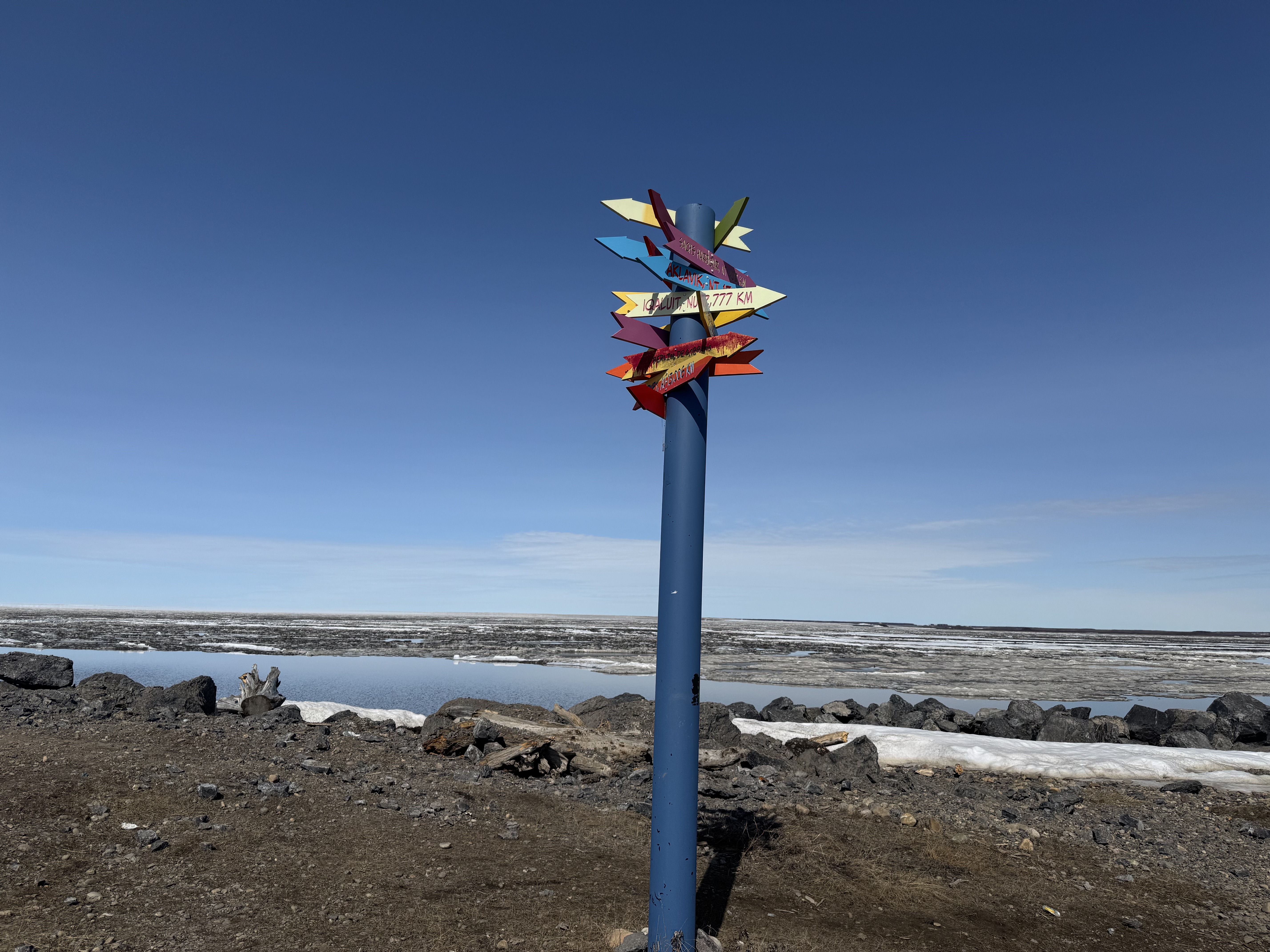
Zoom in to see a few places and their mileage.
Tuktoyaktuk map and points of interest.
Touching the Arctic Ocean! It was so cold you almost couldn't feel it.
The guy that was staying in the trailer behind the sign took our picture for us!
I can't imagine living here and all the hardships these people face and persevere through. They are much tougher than I.
Hiking up a Pingo in town.
View on top.
Video on top of the Pingo.
On the way back to Inuvik from Tuk we saw a moose!
We slept fairly awful this entire trip due to the constant sunlight and the heat. The temps ranged from 70-75 degrees during our visit. It was unbearably hot in the cabin without AC despite the windows open and the ceiling fan and a tower fan going. This photo was taken around midnight and the sun never set.
The next morning, it was time to head back. We planned to make this a marathon trip to complete 771 km (479 miles) in one day so we didn't have to spend anymore on hotels.
Watching the dust fly...
Mackenzie River ferry was a breeze.
We stopped at Fort McPherson to fuel up and "fuel up" with snacks (which I would regret eating a gas station sandwich the next few days).
Sean had looked at the Peel River ferry status the night before and it was closed, so we hoped and prayed the water level would come down and they would reopen. Luckily, they were opening and running!
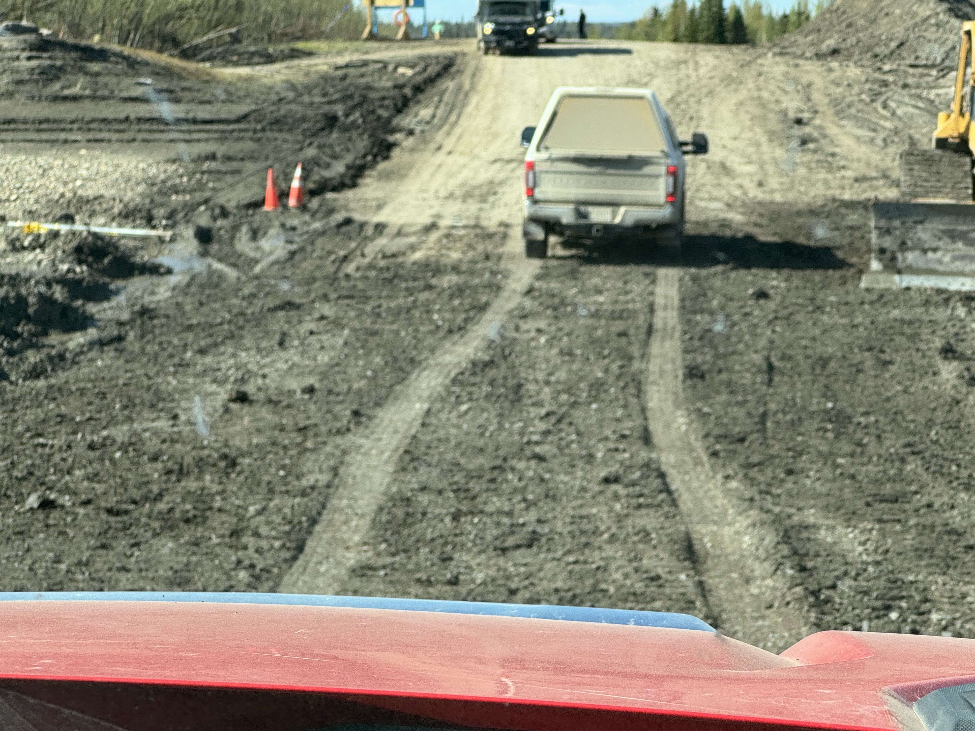
Still working on the landing where we had driven through water before.
Still muddy, but much improved.
The line waiting to cross. Lots of grocery waiting their turn in those semis.
A pic of some road conditions. There were many sunken, washed out areas, and sometimes some large holes.
Back to the Yukon!
Grizzly bear waiting for us on the road.
Video of Mr. Gizzly.
A tip from a friend in the Yukon that there are fossils here. We were trying to find fossils...I had no idea how to distinguish a fossil in any of this, lol.


No comments:
Post a Comment